Munnar Sightseeing | Munnar Hill Station
Munnar is one of the most popular hill-resort towns in Kerala and in southern India. Munnar is located on the Western Ghats, situated in the Idukki district.
The name Munnar is believed to be derived from the Malayalam/Tamil words Munu (three) and aaru (river), referring to the town's strategic location at the confluence of the Muthirappuzha, Nallathanni and Kundaly rivers.
The Munnar panchayat in the Devikulam block is the largest panchayat in the Idukki district having an area measuring nearly 557 km².
The former, mainly in Devikulam Talukas of Idukki district, Kerala is usually known as the
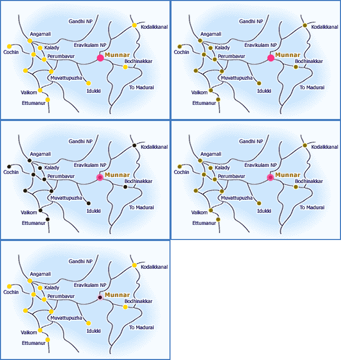
Kannan Devan hills or the High Ranges. The plantations in High Ranges are clustered around the town of Munnar (10 N 77 E) which is about 130 km from Cochin. Kodaikanal, another famous hill-station is just 90kms from Munnar.
Tea estates adds a heavenly charm to the serene landscape. These estates lie at elevations varying from about 1300m (4300 ft.) to 1900 m(6200 ft.) above mean sea level. Munnar is at about 1500 m (4300 ft.) above sea level. Some of the tea field sat 2100 m (7000 ft.), are among the highest in the world. The highest peak in South India - The Anamudi(2695 m/8841 ft.) - is situated in the High Ranges.
The nearest major railway stations are at
Ernakulam and Aluva (approximately 110km by road). The nearest airport is
Cochin International Airport, which is 105km away.
Fast Fact of Munnar:
Location:
Idukki District on the high ranges of the Western Ghats
Altitude:
5000-8000 ft above sea level.
Area:
26.2 sq. km.
Temperature:
0C - 30 C (Summer: 15.2C - 25.8C Winter: 0C - 10 C)
Rainfall:
275 cm
Best time to visit in Munnar:
September to May
Clothing:
Woolen and cotton. A suit if you are staying at the club!
Languages spoken:
Malayalam, Tamil, Hindi and English.
Distance of Munnar from Major Cities:
| Sl No | Place | Distance |
| 1 | Kumarakom | 156 km |
| 2 | Kozhikode | 289 km |
| 3 | Kovalam | 318 km |
| 4 | Kottayam | 142 km |
| 5 | Kollam | 372 km |
| 6 | Kappad | 305 km |
| 7 | Kanyakumari | 424 km |
| 8 | Kannur | 382 km |
| 9 | Kaladi | 100 km |
| 10 | Guruvayoor | 175 km |
| 11 | Cochin | 130 km |
| 12 | Bekel | 461 km |
| 13 | Alleppey | 192 km |
| 14 | Palakkad | 226 km |
| 15 | Sulthanbathery | 456 km |
| 16 | Thekkady | 100 km |
| 17 | Trissur | 146 km |
| 18 | Trivandrum / Thiruvanthampuram | 302 km |
|
Munnar Weather:
Munnar Geography and climate:
The region in and around Munnar varies in height from 2,000 meters (6,562 ft) to 2,600 meters (8,530 ft) above mean sea level. Munnar enjoys a salubrious climate. The temperature ranges between 10 °C (50 °F) and 0 °C (32 °F) in winter and 8 °C (46.4 °F) and 16 °C (60.8 °F) in summer. The tourist season in Munnar is from August to May. However, even the monsoons are lovely with many streams and rivulets in the area and post drizzle the dew drenched tea gardens looking majestic and heavenly enshrouded in light mist.
How To Reach Munnar:

Munnar — Kerala’s beguiling beauty — lies at an unpardoned height, unimaginably, at 5,000 ft. A hotspot envy of inanimate pinnacles, Munnar lies at a confluence of three streams, in the Western Ghats. Several of the attractions in Munnar lie not within the area, rather under the circumsphere of 10-40 km. The hill station of Munnar is widely connected with other south Indian states and its prominent cities through all means of transportation like rail, road and airways. The nearest airport is located at Cochin International Airport and the connecting rail strip is at Aluva and Ernakulam. Alongside, the National Highway 49 and State Highway 17 conjoin Munnar to other places like Maraiyoor, Indira Gandhi National Park and Eravikulam National Park. Many state run buses, KSRTC and SETC buses and AC buses have frequent running to the state. Accessing Munnar through its hair-pin bends and beauteous scape is a great experience for all. Munnar is mantled in a heady aroma of tea. Discover it layer by layer!!!
By Air:
The nearest airport is the spanking new one at Kochi (Cochin) at a distance of 4 hours by road. It receives traffic from all the major Indian cities and from the Gulf.
By Road:
The best way to get to Munnar’s fabulous tea bushes is by road from Kochi. However, the monsoons that do great things for the tea are not half as kind to the roads and the 4 hour journey up by bus may become a prolonged pain in the...back! Take a cab from Kochi, Kottayam (5 hours), Madurai (6 hours), Coimbatore (6 hours too), or Thiruvananthapuram (9 hours). Both rattling state transport and sleeker privately run buses also service these routes.
By Train:
The nearest railway station is also at Kochi, or rather at Ernakulum. The Ernakulum Junction is a major junction in the south; it gets trains from all over the country including frequent ones from Delhi, Chennai, Thiruvananthapuram, Mumbai, Mangalore and Bangalore.
Local Transportation:
Buses, auto-rickashaws and rickshaw comprise local transportation in Munnar. Otherwise, tourists can hire cycles and bikes on rent as a means of transportation here. Raja cycles and Gokulam Bike Hire rent out cars and bikes per day at Rs 250. Autorickshaws run around the hills with bone-shuddering efficiency charging somewhat Rs 150 to Rs 650 for full sightseeing and other places accordingly. Alternatively, buses are also an efficient and cheaper conveyance than autos. Well, Munnar has quiet a decent number of buses running inter and intra-state buses catering to the tourist and locals alike. KSRTC bus stand located to the south of the hill station. Rickshaw is best medium to hop to a short distance. A novel way to sight out Munnar is car hiring. Cars can be hired to the extent of 80 km per day or can be paid meter wise accordingly.
Eravikulam National Park, Rajamala:
Located about 15 km from Munnar, this park is famous for its endangered inhabitant - the Nilgiri Tahr. Spread over an area of 97 sq. km., this park is also home to several species of rare butterflies, animals and birds. A great place for trekking, the park offers a magnificent view of the tea plantations and also the rolling hills caressed by blankets of mists. The park becomes a hot destination when the hill slopes here get covered in a carpet of blue, resulting from the flowering of Neelakurinji. It is a plant endemic to this part of the
Western Ghats which blooms once in twelve years. The last time it bloomed was in 2006.
Marayoor:
Around 40km from Munnar
Marayoor has many firsts to its credit. It is the only place in Kerala with natural growth of
sandalwood trees, natural caves with murals, and relics from Later Stone Age civilisation. There is a sandalwood factory of the Forest Department of Kerala and a children's park extending across one hectare of land under the canopy of a single Banyan tree, all of which attract tourists in large numbers. Some nearby destinations such as Thoovanam and
Rajiv Gandhi National Park are also of great interest.
Anamudi Peak:
Situated about 13 kilometres (8.1 mi) from Munnar town,
Anamudi (2,695 metres (8,842 ft)) is Kerala's highest mountain and the highest Indian mountain south of the Himalayan range. Treks to the peak are allowed with permission from Forest and Wildlife authorities at Eravikulam.
Mattupetty:
Another place of interest, located about 13 km from Munnar Town, is
Mattupetty. Lying at a height of 1700 m above sea level, Mattupetty is known for its storage masonry dam and the beautiful lake, which offers pleasurable boat rides, enabling one to enjoy the surrounding hills and landscape. Mattupetty's fame is also attributed to the dairy farm run by the Indo-Swiss Livestock Project, where one would come across different high yielding breeds of cows. Mattupetty with its lush green tea plantations, rolling grasslands and the Shola forests is also ideal for trekking and is home to a variety of birds.
Pallivasal:
Pallivasal, located at about 3 km from Chithirapuram in Munnar is the venue of the first Hydro-electric project in Kerala. It is a place of immense scenic beauty and is often favoured by visitors as a picnic spot. We at 2x30 MW Pallivasal Power extension scheme Hydro Electric Project, Kerala are extremely happy to inform that Pallivasal Extension Scheme has succeeded in achieving the target of No LTI for the year 2009. The project marked 642,500 safe man-hours with 276,487 kilometer without RTA.All the staff and workers involved with the project can be truly proud of their achievement. The HSE team congratulates and thank all those are associated with the project for cooperating and implementing the safety methods implemented at various sites to achieve this goal.
It may please be noted that implementation of
Pallivasal Hydro Electric Project involves almost 5 kms of underground works out of which we have made progress 1.9 Kms in 2009. Project also involves excavation and laying of large Penstock pipes in hilly terrain. Working conditions are made further difficult due to heavy rains at Project Site for approximately eight months in a year which increases the probability of land slides at various project sites. It is due to the sincere hard work put by each one of us the target of NO LTIin 2009 could be achieved.
In the year 2008 the project had a total of 03 LTI’s and 1 Fatality. In the mean time, to raise the awareness for safety culture we carried out safety campaign, safety training from third party and in-house safety training throughout the project. We started a cross inspection program from different site of the project, with the respective engineer carrying out the site inspection program. Introduction of PTW system was started for controlling any potentially hazardous activity. The results of all these safety measures has paid off. In the state of Kerala where safety culture is very low among the construction sites, it was indeed a massive challenge we have overcome and we have achieved a incident free 2009.
We wish to convey our sincere appreciation to one and all for this proud achievement and remind you that good HSE performance is ‘Teamwork’ and it is a continuous activity.
Suresh Nair, Safety Officer, HSE Dept 2 x 30 MW Pallivasal Extn Scheme HEP
Nadukani:
Situated at an altitude of 3,000 ft. above sea level,
Nadukani offers excellent views of the Moolamattam town,
Malankara lake, etc. It is a natural dream heaven covered with green-clad hills, silvery streams, valleys and paddy fields. You will encounter many rare species here like the hornbill, wild rabbits, spotted sambhar, jungle mainah and elephants, to name a few.
Chinnakanal:
Near the town of Munnar is
Chinnakanal and the waterfalls here, popularly known as Power House Waterfalls, cascade down a steep rock 2000m above sea level. The spot is enriched with the scenic view of the Western Ghat ranges.
Kundale:
Tea Plantation offers an opportunity to see the tea plantations, to watch tea being picked, learn how tea is processed and to buy the tea directly from the gardens. It is an area surrounding a picturesque lake that offers stunning views of the region. If you arrive on a Sunday, make sure to drop in at the small
Kundale Club in the afternoon, where the local planters gather with their families.
Anayirangal:
When you have traveled about seven kilometers from
Chinnakanal, you reach
Anayirangal. Anayirangal, 22 km from Munnar, is a lush green carpet of tea plants. A trip on the splendid reservoir is an unforgettable experience. The
Anayirangal dam is surrounded by tea plantations and evergreen forests.
Top Station:
Top Station, which is about 27 km from Munnar is at a height of 1700 m above sea level. It is the highest point on the
Munnar-Kodaikanal road. Travellers to Munnar make it a point to visit Top Station to enjoy the panoramic view it offers of the neighboring state of Tamil Nadu. It is one of the spots in Munnar to enjoy the Neelakurunji flowers blooming over a vast area.
Tea Museum:
Munnar has a legacy of its own when to comes to the origins and evolution of tea plantations. Taking account of this legacy and to preserve and showcase some of the exquisite and interesting aspects on the genesis and growth of tea plantations in Kerala's high ranges, a museum exclusively for tea was opened some years ago by
Tata Tea in Munnar. This Tea Museum houses curios, photographs and machineries; all of which have a story to tell on the origins and growth of tea plantation in Munnar. The museum is located at the
Nallathanni Estate of Tata Tea in Munnar and is worth a visit.
Pothamedu:
One of the major plantation hubs of Munnar, Pothamedu is situated at a distance of around 6km from the town. Views of coffee, tee, and cardamom plantations are excellent from here and it’s an ideal spot for trekking and hiking amidst lush mountains, rolling hills and breathtaking scenery.
Devikulam:
Is an out-of-the-world experience among exotic flora and fauna, cool mountain air, and velvet lawns. An idyllic hill station,
Devikulam is located at a distance of around 7km from Munnar. The
Sita Devi Lake situated here is an ideal picnic spot with its picturesque surroundings, mineral water, and trout-fishing facilities.
Nyayamakad:
An excellent picnic and trekking point,
Nyayamakad is situated at a distance of 10km from Munnar near Rajamalai, Nyayamakad is a land of scintillating waterfalls with water cascading down from a height of around 1,600 metres.
Valara:
10kms from Adimali on the Kochi-Madurai highway.
Valara has a chain of waterfalls surrounded by thick green forests worth exploring.
Flora and Fauna in Munnar:
Most of the native flora and fauna of Munnar have disappeared due to severe habitat fragmentation resultant from the creation of the plantations. However, some species continue to survive and thrive in several protected areas nearby, including the new
Kurinjimala Sanctuary to the east, the
Chinnar Wildlife Sanctuary, Manjampatti Valley and the Amaravati reserve forest of
Indira Gandhi Wildlife Sanctuary to the north east, the Eravikulam National Park and Anamudi Shola National Park to the north, the
Pampadum Shola National Park to the south and the proposed
Palani Hills National Park to the east. These protected areas are especially known for several threatened and endemic species including Nilgiri Thar, the Grizzled Giant Squirrel, the Nilgiri Wood-pigeon, Elephant, the Gaur, the Sambar, and the Neelakurinji (that flowers once in twelve years).
Munnar Hotels:
- Royal Retreat
- Munnar Inn
- Fort Munnar
- Hotel Hill view
- West Wood Hotel
- Hotel Igloo
- T &U Leisure Hotel
- C7 Hotels
- Chancellor (Ayur County)
- The Tall Trees
- Issacs Residency
- Edassery Eastend
- The Sienna Village
- Munnar Tourist Home
- Olive Brook & Shamrock
- Munnar Rock
- Blackberry Hills Mountain Eco Lodges
Munnar Resorts:
- Holiday Heaven Resort
- Westwood Riverside Garden Resorts
- Tea County Hill Station Resort
- The Siena Village
- Abad Copper Castle Hill Valley Resorts
- Camelot Resorts
- Sterling Resort Munnar
- Great Escapes Resorts
- Deshadan Mountain Resorts
- Rangerwoods Hills Resort
- Elysium Gardens Hill Resorts
- Misty Mountain Resort
- Club Mahindra Lake View Resort
- Forest Haven Resort
- Birds Lagoon Village Resort
- Spring Dale Resort
Tourist Information Office:
District Tourism Office, Kumily.DTPC Information Centre, Old Munnar.
Munnar Map:
Munnar Photos:
A.Settu B.E.,
System Support Engineer,
VDA Infosolution Pvt Ltd